GISVENTURE
Explore. Map. Transform the World.
Explorations in remote sensing and GIS. Each one states what the data supports, where it stops, and what it connects to.

-
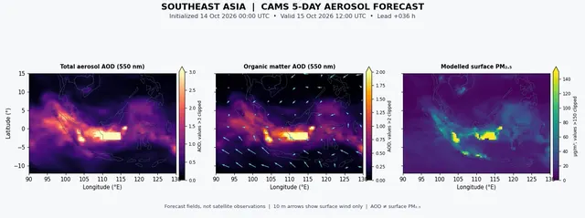
Southeast Asia’s haze: fires and forecasts together
Aerosols, VIIRS active fires with CAMS five-day forecasts
- Shows
- Modelled mean aerosol optical depth falling by about 43% over five days, unevenly.
- Doesn’t show
- Smoke travelling from particular fires to particular places.
- Connected to
- Fire activity, winds at several heights, vertical mixing, rain washout.
-
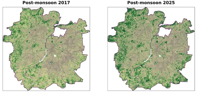
Two NDVI maps are not the whole story
Vegetation change, Ahmedabad, Sentinel-2, 2017–2026
- Shows
- Post-monsoon NDVI was higher in 2025 than in 2017.
- Doesn’t show
- A steady rise. The years between swung up and down.
- Connected to
- Rainfall and monsoon timing, vegetation phenology, irrigation, urban expansion.
-
Why understanding the landscape matters in mangrove restoration
Essay, mangrove restoration
-
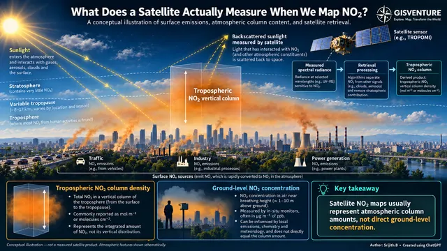
What does a satellite measure when we map NO₂?
Air quality explainer, Sentinel-5P TROPOMI
- Shows
- How much NO₂ sits in the whole tropospheric column.
- Doesn’t show
- The concentration at breathing height.
- Connected to
- Emissions, wind and mixing, atmospheric chemistry, weather.
-
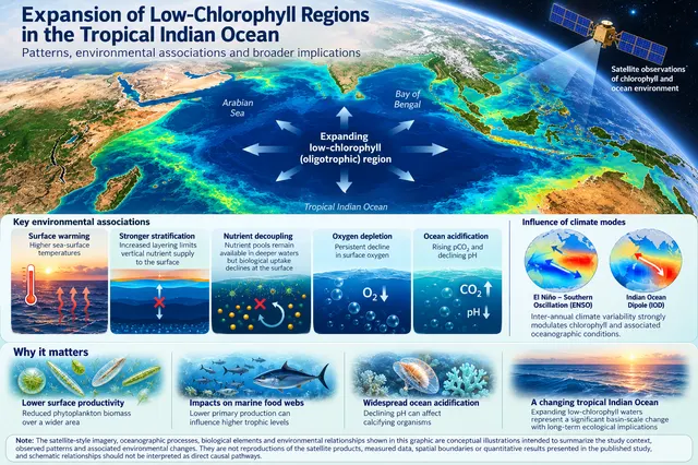
Low-chlorophyll waters are spreading in the tropical Indian Ocean
Paper explainer, ocean colour, 2015–2024
- Shows
- Regional and seasonal expansion of low-chlorophyll area, alongside warming, oxygen and pH changes.
- Doesn’t show
- A single cause. El Niño and the Indian Ocean Dipole shape the decade too.
- Connected to
- Surface warming, stratification, nutrient supply, monsoons, El Niño and the IOD.
-
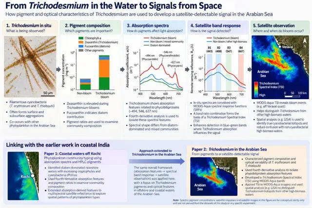
From Trichodesmium in the water to signals from space
Paper explainer, Arabian Sea, MODIS-Aqua
- Shows
- A spectral index that carries bloom pigment features through to satellite bands.
- Doesn’t show
- That every high-biomass patch is Trichodesmium. Spatial analysis is needed to separate them.
- Connected to
- Mixed phytoplankton communities, biomass variability, coastal water optics.
No matching items